
Page 38 - Garmin_Inland
P. 38
Sonar Technology
®
GPSMAP 276Cx GPSMAP 78s, 78 & GPS 73
®
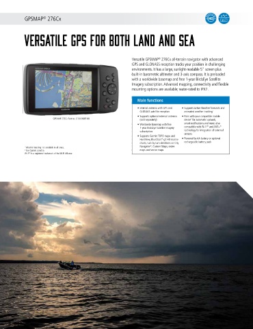
versatile GPS for both land and sea Top choice handhelds for all mariners
®
Versatile GPSMAP 276Cx all-terrain navigator with advanced
GPS and GLONASS reception tracks your position in challenging Boaters and watersport enthusiasts everywhere swear by the Cartography & Apps
environments. It has a large, sunlight-readable 5" screen plus GPSMAP 78 handhelds. They feature a bright 2.6" LCD color
built-in barometric altimeter and 3-axis compass. It is preloaded display with built-in worldwide basemap and a special MOB
with a worldwide basemap and free 1-year BirdsEye Satellite (man overboard) button. What's more, these waterproof devices
Imagery subscription. Advanced mapping, connectivity and flexible are designed to float. SailAssist for GPS 73 include virtual
mounting options are available; water-rated to IPX7. starting line, heading line, countdown timers and tack assist.
Main functions Main functions Software & Features
®
• Internal antenna with GPS and • Supports Active Weather forecasts and • 2.6" LCD color display (78/78s), 2,6" 4 • Can be enhanced with BlueChart g2
GLONASS satellite reception animated weather tracking 1 level gray LCD (73) HD charts
• Supports optional external antenna • Pairs with your compatible mobile • Highly sensitive GPS receiver for • NMEA 0183 support
GPSMAP 276Cx Part no.: 010-01607-00 (sold separately) device for automatic uploads, optimum reception and performance • Wireless data transfers
2
™
• Worldwide basemap with free smart notifications and more; also ® • Slot for microSD card and USB interface • SailAssist for GPS 73 include virtual
™
®
1-year BirdsEye Satellite Imagery compatible with Wi-Fi and ANT+ • Sunrise/sunset, estimated time of arrival, starting line, heading line, countdown
subscription technology for integration of external other calculations and marine data timers and tack assist
sensors
• Supports Garmin TOPO maps and • MOB (man overboard) button: shows • Marine alarms (including off course,
HuntView, BlueChart g2 HD marine • Powered by AA battery or optional 78s Part no.: 010-00864-01 distance and bearing to the position anchor drag and more)
®
charts, turn by turn directions on City rechargeable battery pack GPS 73 Part no.: 010-01504-00 78 Part no.: 010-00864-00 where the button was pressed Chartplotters & Combos
®
1 Weather tracking not available in all areas. Navigator , Custom Maps, raster
2 See Garmin.com/ble. maps and vector maps
Wi-Fi ® is a registered trademark of the Wi-Fi Alliance.
inReach SE + & inReach Explorer +
®
®
2-WAY SATELLITE COMMUNICATORS Fishfinders
®
inReach SE + is the satellite communicator that uses 100% global
Iridium satellite coverage for 2-way messaging anywhere in the
world. In case of emergency, the interactive SOS allows you to
communicate back and forth and receive confirmation that help is on Wearables & Handhelds
the way. Navigate with detailed, preloaded. inReach Explorer + has
®
1
TOPO maps , follow routes, mark waypoints and finds your way back.
Main functions
• Satellite communicator and GPS • Send and receive text messages while
navigator with 100% global Iridium beyond cell phone range
satellite coverage • Use the MapShare site to track and share
• View preloaded DeLorme TOPO maps 1 your location online with family and Specs & Networks
overlaid with GPS waypoints and routes, friends, so they can ping your device and
right on the full-color display send you messages
2
• Built-in, high-sensitivity GPS provides • Pair with mobile devices using the free
®
robust navigation with TOPO, location Earthmate app for access to TOPO
and tracking data within 5 meters maps and U.S. NOAA charts, color aerial
and better accuracy than a paired/ imagery and more. Additional data for
companion mobile device; follow routes, hunters, such as game
drop waypoints and find your way back
inReach SE ® + Part no.: 010-01735-00 with a high-detail bread crumb trail
inReach Explorer ® + Part no.: 010-01735-11
1 Preloaded DeLorme TOPO maps are not compatible with other Garmin devices. Pricing & Support
Other Garmin maps not compatible with this device.
2 See Garmin.com/inreachfaq for compatibility.
36 GARMIN.COM